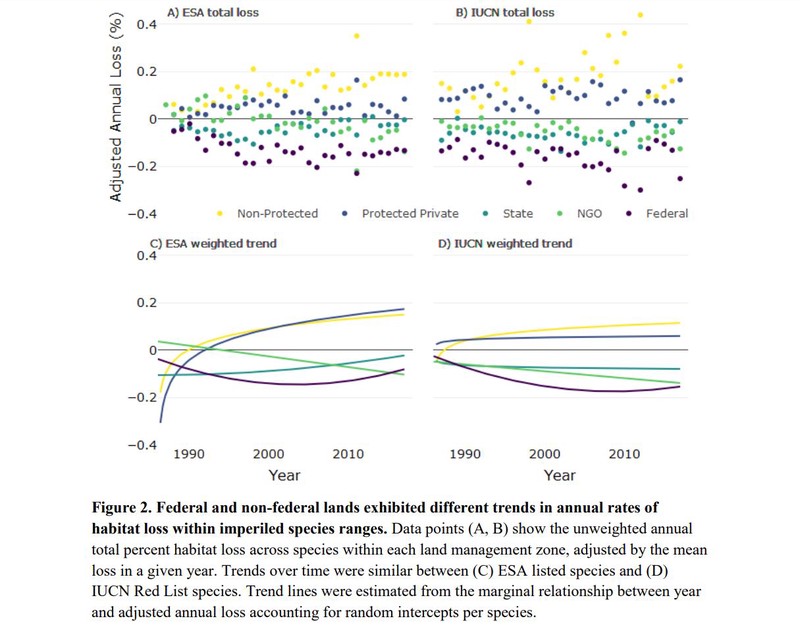
To stem the ongoing loss of biodiversity, there is an urgent need to distinguish effective and ineffective approaches to protecting species and their habitats. Conservation laws may be strong on paper but ineffective in practice, or vary in effectiveness across different contexts, such as different land ownership and management settings. Using Google Earth Engine and 30 years of Landsat satellite images, we quantify annual habitat change for 24 species on the U.S. Endangered Species List and IUCN Red List across different categories of land ownership, such as federal, state, and private. We show that imperiled species lost very little habitat on federal lands (3.6%), while losses on non-protected private lands (8.1%) were twice as great. Patterns of loss suggest that listing species under the Endangered Species Act was one mechanism limiting habitat loss, and that the law was most effective on federal lands. These results emphasize the importance of federal lands for protecting habitat for imperiled species, but also highlight the need to improve habitat protection on private lands for long-term conservation.
As the previous Senior Conservation Data Scientist in the Center for Conservation Innovation at Defenders, Mike led geoinformatics and data science projects to inform and improve conservation.