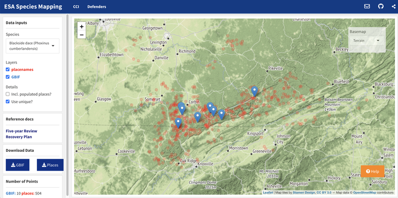
Historically, the range maps used in implementing the Endangered Species Act (ESA) have been only county-level resolution. As part of a long-running project to help refine those maps to improve the efficiency of implementing the ESA, CCI developed a method to extract placenames from regulatory documents - here, recovery plans and five-year reviews - and map them alongside GBIF records, where available. This proof-of-concept app illustrates that structured, geographically explicit information can be extracted from existing documents (i.e., unstructured data) to improve maps to help conserve listed species.
As the previous Director in the Center for Conservation Innovation at Defenders, Jacob led CCI’s work at the intersection of science, technology, and policy to improve conservation outcomes, especially for threatened and endangered species.