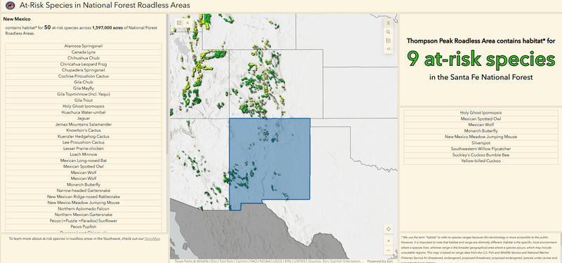
Even though roadless areas only make up 2% of land in the lower 48 states, they contain habitat for 57% of vulnerable terrestrial wildlife. Every roadless area provides habitat for at least two vulnerable wildlife species. This dashboard allows you to see at-risk animals in your area. See the story map that accompanies this dashboard here.
As the Conservation GIS Analyst, Becca provides mapping and geospatial analysis services throughout Defenders to support conservation of wildlife across North America.