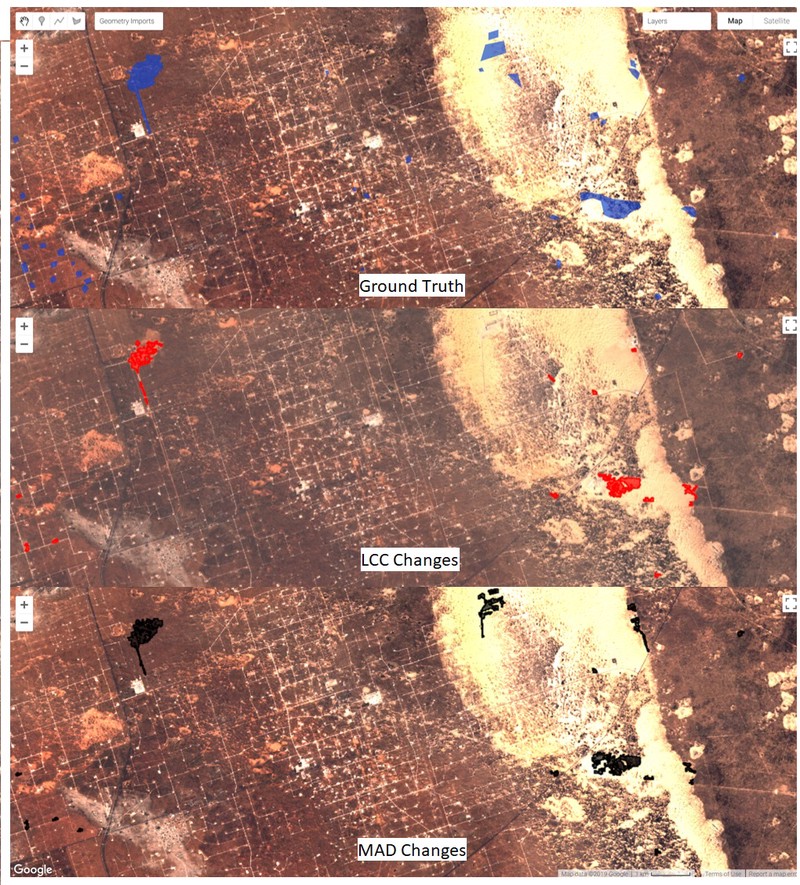
A significant limitation in biodiversity conservation has been the effective implementation of laws and regulations that protect species habitats from degradation. Flexible, efficient, and effective monitoring and enforcement methods are needed to help conservation policies realize their full benefit. As remote sensing data become more numerous and accessible, they can increasingly be used to identify and quantify land use changes and habitat loss. However, these data remain underused for systematic conservation monitoring in part because of a lack of simple tools. We adapted and developed two generalized methods that automatically detect landscape changes in a variety of habitat types using free and publicly available data and tools. We evaluated the performance of these algorithms in two ways. First, we tested the algorithms over 50 sites of known change in the United States, finding these approaches were effective (AUC > 0.90) at distinguishing between areas of habitat loss and areas of no change. Second, we evaluated algorithm effectiveness by comparing results to manually identified areas of change in four case studies of imperiled species habitat: oil and gas development in the range of the Greater Sage Grouse; sand mining operations in the range of the dunes sagebrush lizard; loss of Piping Plover coastal habitat in the wake of hurricane Michael (2018); and residential development in beach mouse habitat. These case studies indicate different performance of each algorithm in different habitats, but that both provide effective means to detect and delineate loss of habitat. The results show how these algorithms can be used to help close the implementation gap of monitoring and enforcement in biodiversity conservation and point to next steps in advancing remote sensing for conservation.
As the previous Senior Conservation Data Scientist in the Center for Conservation Innovation at Defenders, Mike led geoinformatics and data science projects to inform and improve conservation.