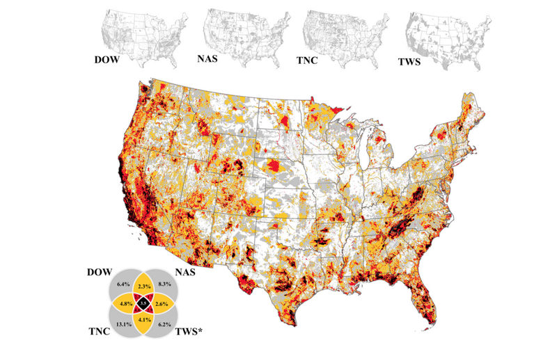
Deciding where to implement actions for biodiversity conservation remains challenging for many reasons, including the increase in maps aimed at prioritizing locations for conservation efforts. Although a growing numbers of maps can create the perception of uncertainty and competing science, a shared set of principles underlie many mapping initiatives. We overlaid the priority areas identified by a subset of maps to assess the extent to which they agree. The comparison suggests that when maps are used without understanding their origin, confusion seems justified: The union of all maps covers 73% of the contiguous United States, whereas the intersection of all maps is at least 3.5%. Our findings support the need to place a strong focus on the principles and premises underpinning the maps and the end users’ intentions. We recommend developing a science-based guidance to aid scientists, policymakers, and managers in selecting and applying maps for supporting on-the-ground decisions addressing biodiversity loss and its interconnected crises.
As the previous VP of the Center for Conservation Innovation at Defenders, Lindsay led the Center for Conservation Innovation’s science, technology, and policy teams.