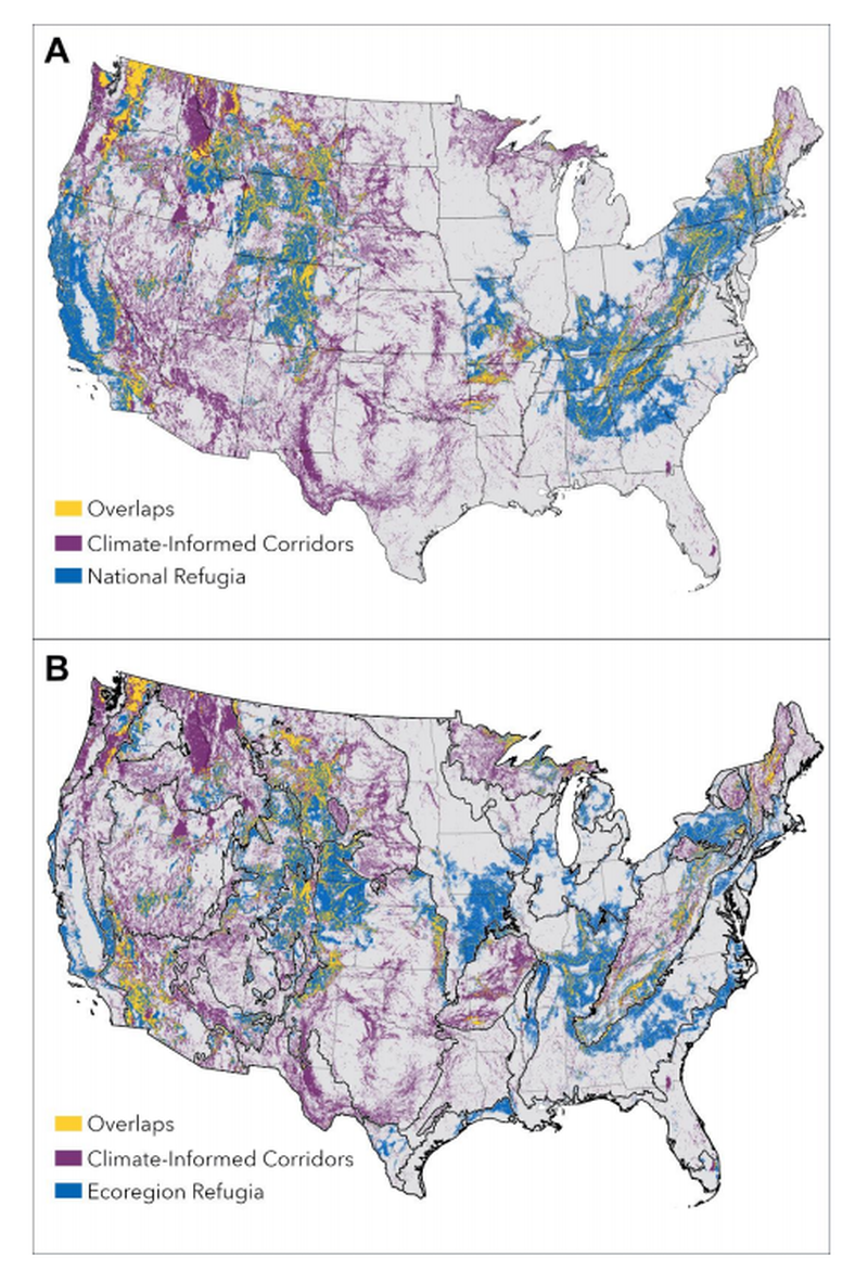

Protecting areas for climate adaptation will be essential to ensuring greater opportunity for species conservation well into the future. However, many proposals for protected areas expansion focus on our understanding of current spatial patterns, which may be ineffective surrogates for future needs. A science-driven call to address the biodiversity and climate crises by conserving at least 30% of lands and waters by 2030, 30x30, presents new opportunities to inform the siting of new protections globally and in the U.S. Here we identify climate refugia and corridors based on a weighted combination of currently available models; compare them to current biodiversity hotspots and carbon-rich areas to understand how 30x30 protections siting may be biased by data omission; and compare identified refugia and corridors to the Protected Areas Database to assess current levels of protection. Available data indicate that 20.5% and 27.5% of identified climate adaptation areas (refugia and/or corridor) coincides with current imperiled species hotspots and carbon-rich areas, respectively. With only 12.5% of climate refugia and corridors protected, a continued focus on current spatial patterns in species and carbon richness will not inherently conserve places critical for climate adaptation. However, there is ample opportunity for establishing future-minded protections: 52% of the contiguous U.S. falls into the top quartile of values for at least one class of climate refugia. Nearly 27% is already part of the protected areas network, but managed for multiple uses that may limit their ability to contribute to the goals of 30x30. Additionally, nearly two-thirds of nationally identified refugia coincide with ecoregion-specific refugia suggesting representation of nearly all ecoregions in national efforts focused on conserving climate refugia. Based on these results, we recommend that land planners and managers make more explicit policy priorities and strategic decisions for future-minded protections and climate adaptation.