Nature divided, scientists united: US-Mexico border wall threatens biodiversity and binational conservation
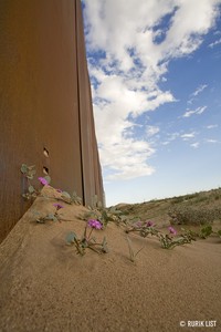
Fences and walls erected along international boundaries in the name of national security have unintended but significant consequences for biodiversity (Trouwborst et al. 2016). In North America, along the 3,200 kilometer U.S.-Mexico border, fence and …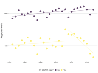
The Texas Conservation Plan has not slowed oil and gas well development in dunes sagebrush lizard habitat
**Background:** The dunes sagebrush lizard (Sceloporus arenicolus) is an imperiled species that is restricted to shinnery oak (Quercus havardii) sand dune habitats in southeastern New Mexico and West Texas, USA. This region is also a hotspot of oil …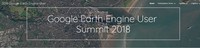
Conservation workflows in Earth Engine
Interested in using Earth Engine for conservation work? This is the session for you. Dave Thau will give a quick overview of conservation-related efforts and datasets in Earth Engine. We'll have summit participants from Conservation International, …
Dunes Sagebrush Lizard: The Cautionary Tale of a Candidate Species Denied
This white paper explains the problems with the U.S. Fish & Wildlife Service's recent decision to not list the dunes sagebrush lizard and recommends improvements to Service regulations and procedures to address these problems. Our …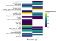
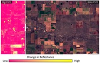
Free aerial imagery as a resource to monitor compliance with the Endangered Species Act
Compliance monitoring is an integral part of law and policy implementation. A lack of compliance monitoring for the Endangered Species Act (ESA), driven in part by resource limitations, may be undercutting efforts to recover threatened and endangered …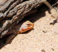
Sand Mines Destroying Dunes Sagebrush Lizard Habitat
At Defenders’ Center for Conservation Innovation, we are using satellite images to track the footprint of all sand mines within or adjacent to lizard habitat. To see monthly images of the sand mines to date, follow the link below to our interactive …
At Risk Species
<h3>-OBSOLETE-</h3> The U.S. Fish and Wildlife Service's Southeast Region assembled a small Microsoft Access database of non-listed, at-risk species, with a focus on species petitioned for listing under the Endangered Species Act. We …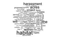
ESA Section 7 Incidental Take (FWS)
An analysis of incidental take data authorized and recorded by the US Fish and Wildlife Service in their TAILS database.