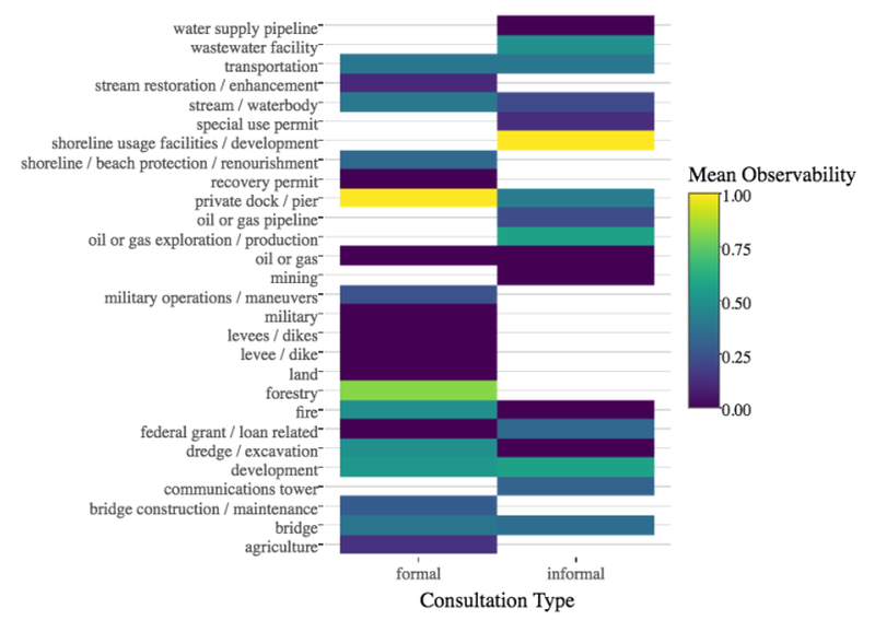
Compliance monitoring is an integral part of law and policy implementation. A lack of compliance monitoring for the Endangered Species Act (ESA), driven in part by resource limitations, may be undercutting efforts to recover threatened and endangered species. Here we evaluate the utility of freely available satellite and aerial imagery as a cost-efficient component of ESA compliance monitoring. Using data on actions authorized by the U.S. Fish and Wildlife Service (FWS) under section 7 of the ESA, we show that approximately 40% of actions can be found in remotely sensed imagery. Some types of actions, such as residential and commercial development, roadwork, and forestry, show substantially higher observability. Based on our results and the requirements of compliance monitoring, we recommend FWS standardize data collection requirements for consultations; record and publish terms and conditions of consultations; and encourage their staff to use technology such as remotely sensed data as a central part of their workflow for implementing the ESA.
As the previous Director in the Center for Conservation Innovation at Defenders, Jacob led CCI’s work at the intersection of science, technology, and policy to improve conservation outcomes, especially for threatened and endangered species.