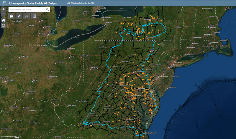
The growth of renewable energy is critical to slowing climate change, and the number of solar energy facilities has been expanding within the U.S. With such a rapid increase, there is a need to quickly update maps of these facilities - information that often does not exist. CCI has used artificial intelligence and satellite imagery to produce a comprehensive dataset documenting the location and footprint of all solar arrays within the Chesapeake Bay watershed. These data are publicly available and can now be used by other researchers and policy makers to understand the distribution and impact of solar development in this ecologically sensitive region. CCI’s partner on this project, the Chesapeake Conservancy, is using these data to update a high-resolution map of landcover to understand hydrologic dynamics within the bay watershed. Beyond the Chesapeake, the AI model that CCI developed can be used to rapidly map solar arrays in other parts of the country and at different points in time.
As the previous Senior Conservation Data Scientist in the Center for Conservation Innovation at Defenders, Mike led geoinformatics and data science projects to inform and improve conservation.