A Season Independent U-net Model for Robust Mapping of Solar Arrays Using Sentinel-2 Imagery
We have an unprecedented ability to map the Earth's surface as deep learning technologies are applied to an abundance of high-frequency Earth observation data. Simple, free, and effective methods are needed to enable a variety of stakeholders to …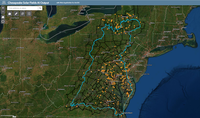
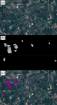
Chesapeake Solar Fields AI Output
The growth of renewable energy is critical to slowing climate change, and the number of solar energy facilities has been expanding within the U.S. With such a rapid increase, there is a need to quickly update maps of these facilities - information …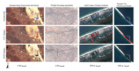
Supporting habitat conservation with automated change detection in Google Earth Engine
A significant limitation in biodiversity conservation has been the effective implementation of laws and regulations that protect species' habitats from degradation. Flexible, efficient, and effective monitoring and enforcement methods are needed …
From Pixels to Objects: Detecting Habitat Change with AI
In this webinar, Senior Conservation Data Scientist Mike Evans shares the work that CCI has been doing to develop automated change methodology, discusses examples in which CCI has used these tools to positively impact conservation efforts, and shares …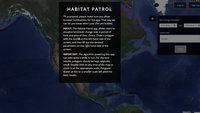
Habitat Patrol
Laws and regulations that protect imperiled species and their habitats are often limited by inadequate monitoring and enforcement. We developed Habitat Patrol to help address this critical need. Habitat Patrol is a free, public web application that …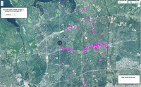
Computer Vision for Renewable Energy
Defenders of Wildlife supports the development of renewable energy sources and works to ensure that this development is done in a manner that does not negatively impact wildlife. We used artificial intelligence technology and satellite data to help …