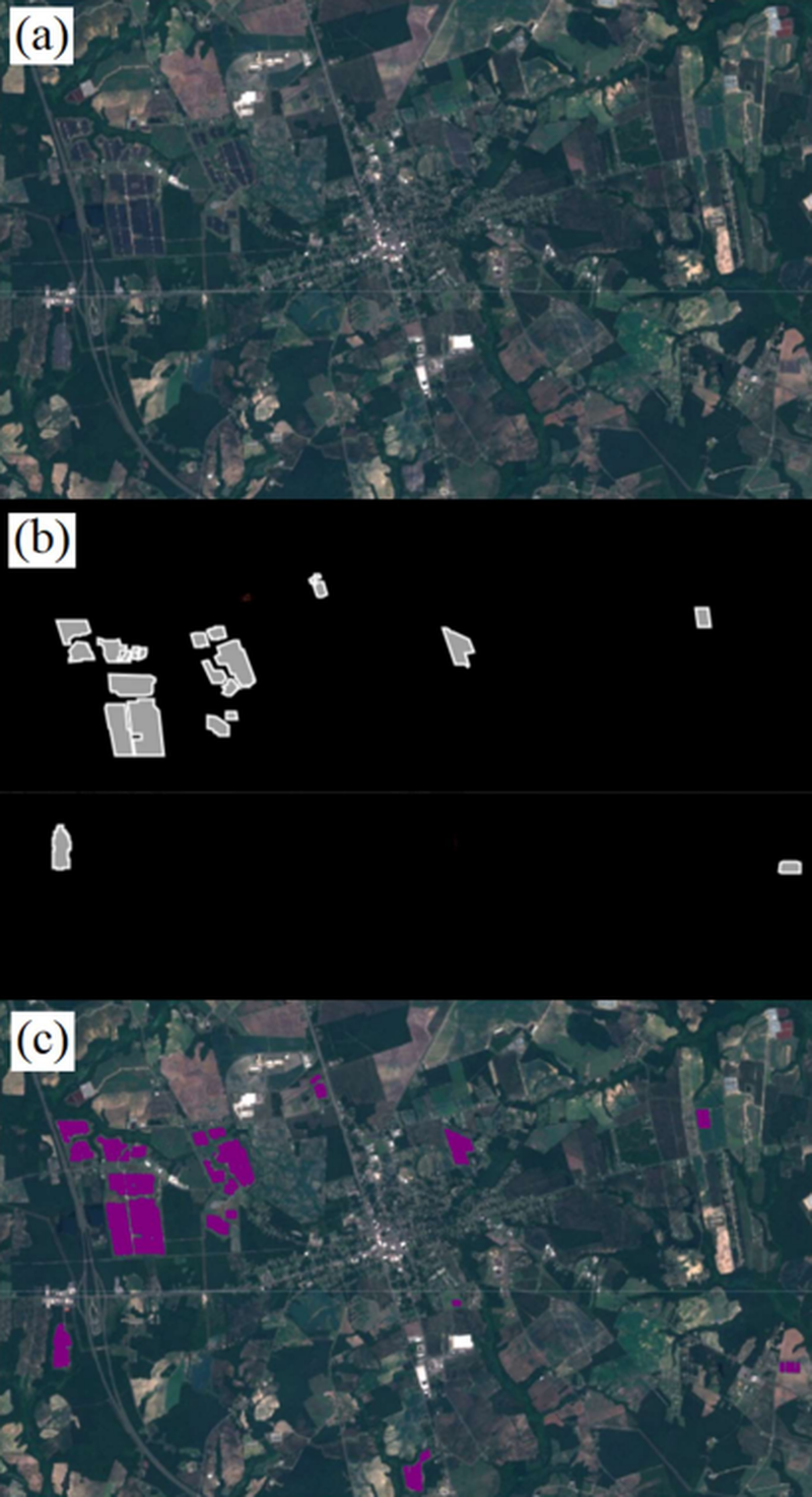
We have an unprecedented ability to map the Earth’s surface as deep learning technologies are applied to an abundance of high-frequency Earth observation data. Simple, free, and effective methods are needed to enable a variety of stakeholders to use these tools to improve scientific knowledge and decision making. Here we present a trained U-Net model that can map and delineate ground mounted solar arrays using publicly available Sentinel-2 imagery, and that requires minimal data pre-processing and no feature engineering. By using label overloading and image augmentation during training, the model is robust to temporal and spatial variation in imagery. The trained model achieved a precision and recall of 91.5% each and an intersection over union of 84.3% on independent validation data from two distinct geographies. This generalizability in space and time makes the model useful for repeatedly mapping solar arrays. We use this model to delineate all ground mounted solar arrays in North Carolina and the Chesapeake Bay watershed to illustrate how these methods can be used to quickly and easily produce accurate maps of solar infrastructure.
As the previous Senior Conservation Data Scientist in the Center for Conservation Innovation at Defenders, Mike led geoinformatics and data science projects to inform and improve conservation.