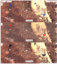
Automated habitat change detection methods using satellite data to improve conservation law implementation.
A significant limitation in biodiversity conservation has been the effective implementation of laws and regulations that protect species habitats from degradation. Flexible, efficient, and effective monitoring and enforcement methods are needed to …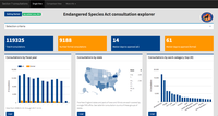
Section 7 Explorer
<h3>-OBSOLETE-</h3> A Shiny app to explore section 7 consultation data from the U.S. Fish and Wildlife Service over the period 2008-2018. All data are from the Service's TAILS database, checked for basic errors, and duplicates removed …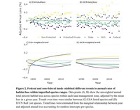
30 years of satellite data show imperiled species are most vulnerable to habitat loss on private lands
To stem the ongoing loss of biodiversity, there is an urgent need to distinguish effective and ineffective approaches to protecting species and their habitats. Conservation laws may be strong on paper but ineffective in practice, or vary in …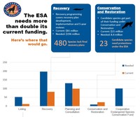
Endangered Species Act Funding
An analysis of the funding needed for the US Fish and Wildlife Service to properly implement the US Endangered Species Act.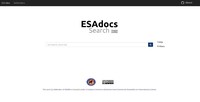
ESAdocs Search
Thousands of pages of ESA-related documents are created every year, each containing important and helpful information for conserving species. We've collected over 500,000 pages of these documents and made them fully searchable in this publicly …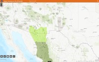
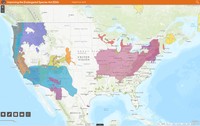
Jaguar Recovery on the U.S. Border
The jaguar is an important keystone predator whose range extends from South America through the Southwestern U.S. This web map shows recovery zones from the species' recovery plan as well as occurrence records in the Southwest.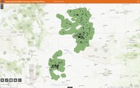
Lesser Prairie Chicken Recovery in the Great Plains
The Lesser Prairie-Chicken is an imperiled species that was formerly listed as a threatened species, but was delisted in a court decision. This web map shows the species' range in the southern High Plains.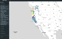
NMFS West Coast Salmon Range (BETA)
<h3>-OBSOLETE-</h3> An alpha-stage app to view the areas occupied by Pacific Coast salmon listed under the Endangered Species Act. Please [get in touch](mailto:cci@defenders.org) if you would like to work on advancing this tool.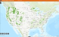
Protecting Habitat on Federal Lands
Over 1/4 of lands in the U.S. are federally owned and are essential to protecting wildlife. This simple web map shows many of the major land management units in the country.