Border Wall: Map of August 30, 2019 DHS Waiver

Border Wall: Map of August 30, 2019 DHS Waiver

Border Wall: Map of August 30, 2019 DHS Waiver

Border Wall: Map of August 30, 2019 DHS Waiver

Abstract

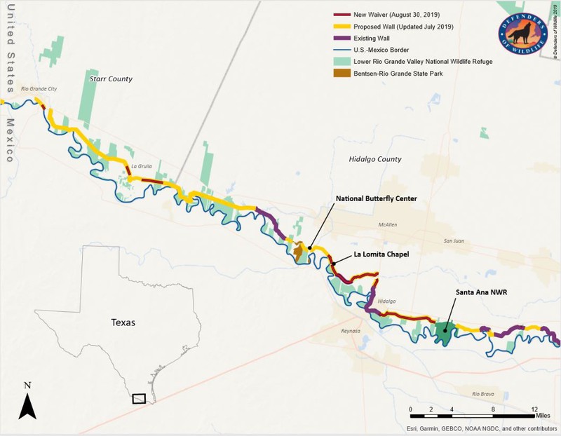
The Trump Administration has continued to advance work on the border wall between the U.S. and Mexico. Recently, the Department of Homeland Security (DHS) formally announced waivers for new sections of wall along the border in the Lower Rio Grande Valley in Texas. Here we map those waivers and show their locations relative to public lands and areas with and without currently existing border wall.

Type
Publication
Defenders Map
Border wall Public lands Planning Monitoring
Avatar
Mae Lacey
Previous Conservation GIS Analyst

As the previous Conservation GIS Analyst in the Center for Conservation Innovation, Mae provided support and leadership for geospatial product development across Defenders.

Related