Border Wall: Map of February 2019 DHS-DOD Request

Border Wall: Map of February 2019 DHS-DOD Request

Border Wall: Map of February 2019 DHS-DOD Request

Border Wall: Map of February 2019 DHS-DOD Request

,

Abstract

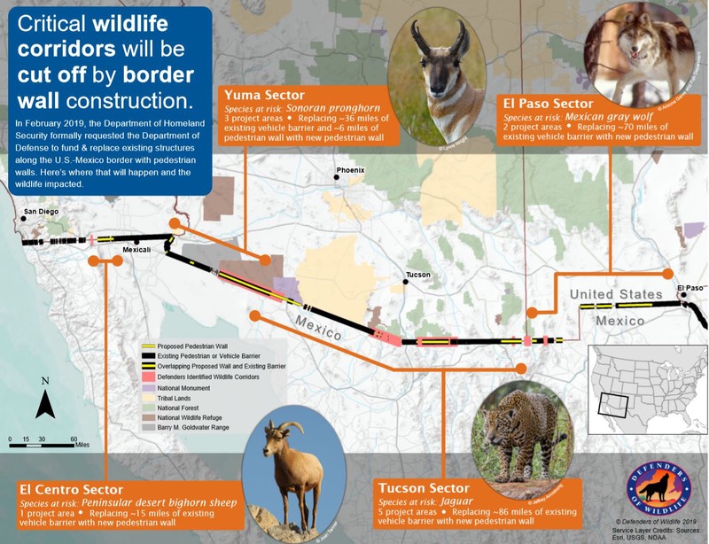
The Trump Administration has continued to advance work on the border wall between the U.S. and Mexico. Recently, the Department of Homeland Security (DHS) made a formal request to the Department of Defense to build extensive new sections of wall in western portions of the border. Here we map those sections and show that they will overlap significantly with wildlife corridors Defenders of Wildlife has identified throughout the area.

Type
Publication
Defenders Map
Border wall Wildlife corridors Public lands Planning Monitoring
Avatar
Mae Lacey
Previous Conservation GIS Analyst

As the previous Conservation GIS Analyst in the Center for Conservation Innovation, Mae provided support and leadership for geospatial product development across Defenders.

Related