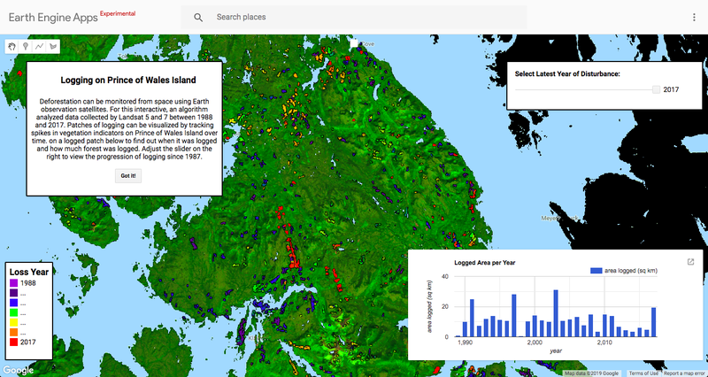
Deforestation can be monitored from space using Earth observation satellites. For this interactive, an algorithm analyzed data collected by Landsat 5 and 7 between 1988 and 2017. Patches of logging can be visualized by tracking spikes in vegetation indicators on Prince of Wales Island over time. on a logged patch below to find out when it was logged and how much forest was logged. Adjust the slider on the right to view the progression of logging since 1987.
As the previous Senior Conservation Data Scientist in the Center for Conservation Innovation at Defenders, Mike led geoinformatics and data science projects to inform and improve conservation.